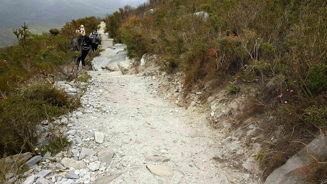
Bluff Knoll is a 6.3 kilometer moderately trafficked out and back trail located near Stirling Range National Park, Western Australia, Australia that features beautiful wild flowers and is rated as difficult. The trail is primarily used for hiking and walking.
Note: Trail may be CLOSED due to bushfires. Please check the park page for more information. Bluff Knoll, at 1,095m above sea level, is the highest peak in the south-west. The main face of the Bluff forms one of the most impressive cliffs in the Australian mainland. It takes three to four hours to complete the 6km return walk. Walking is not recommended in wet or windy conditions or in extreme heat. Bluff Knoll was called Pualaar Miial ('great many faced hill') by the local Aboriginal people. This was because the rocks on the Bluff were shaped like faces. The peak is often covered with mists, which curl around the mountain tops and float into the gullies. These constantly changing mists were believed to be the only visible form of a spirit called Noatch (meaning dead body or corpse), who had an evil reputation. The Stirling Range is renowned for its unusual, and sometimes spectacular, cloud formations. Park visitors may notice two types of unusual cloud formations about the peaks, often when the rest of the sky is clear. A shallow, low-level stratified cloud that drapes over the higher peaks is a familiar sight. Another type of shallow cloud layer may leave the higher peaks exposed, which is a unique sight in WA.
Tuesday

33° / 15° C
Wednesday

22° / 11° C
Thursday

18° / 10° C
Friday

19° / 11° C
Saturday

19° / 13° C


